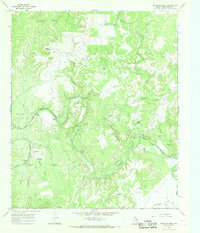
1966 Map of Reynolds Bend
USGS Topo · Published 1968About this map
Clear Fork Brazos River carves a deep, serpentine path through this Throckmorton County landscape, defining the local geography with its many loops and crossings. The area around Reynolds Bend reveals a ranching and rural economy punctuated by family landmarks and early Texas history. Remnants of former habitation are visible through labels for Indian Village Ruins and Tecumseh Ruins, while the presence of the Treadwell Cem and Reynolds Bend Cem provides specific points of interest for genealogists tracing early settlers.
Find a feature on this map
40 named features on this map. Tap any name to fly to it.
Don’t see what you’re looking for? This feature index may not catch every label — zoom into the map to look around manually.
Map Details
Editions of this 1966 Reynolds Bend Map
2 editions found
Other maps of this area

1892 · Albany
USGS Topo · 1:125,000

1893 · Albany
USGS Topo · 1:125,000

1954 · Abilene
USGS Topo · 1:250,000

1954 · Wichita Falls
USGS Topo · 1:250,000

1958 · Wichita Falls
USGS Topo · 1:250,000

1958 · Abilene
USGS Topo · 1:250,000

1965 · Collins Creek
USGS Topo · 1:24,000
1965 · Antelope Hills
USGS Topo · 1:24,000

1965 · Fort Griffin
USGS Topo · 1:24,000

1965 · Reynolds Bend NW
USGS Topo · 1:24,000
Featured Places
- Bartholomew Crossing, TX
- Hayford Crossing, TX
- Reynolds Crossing, TX
- Paint Crossing, TX
- McKeichan Crossing, TX