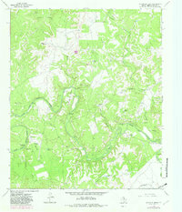
1966 Map of Reynolds Bend
USGS Topo · Published 1982About this map
The Clear Fork Brazos River carves a winding path through this portion of Throckmorton County, creating dramatic topographic relief at Hittson Bluff and the prominent S Bend. This mid-century survey documents a landscape where ranching history and frontier archaeology intersect. Notable historic sites are scattered along the riverbanks, including the Camp Cooper Ruins, Tecumseh Ruins, and Indian Village Ruins.
Find a feature on this map
35 named features on this map. Tap any name to fly to it.
Don’t see what you’re looking for? This feature index may not catch every label — zoom into the map to look around manually.
Map Details
Editions of this 1966 Reynolds Bend Map
2 editions found
Other maps of this area

1892 · Albany
USGS Topo · 1:125,000

1893 · Albany
USGS Topo · 1:125,000

1954 · Abilene
USGS Topo · 1:250,000

1954 · Wichita Falls
USGS Topo · 1:250,000

1958 · Wichita Falls
USGS Topo · 1:250,000

1958 · Abilene
USGS Topo · 1:250,000

1965 · Collins Creek
USGS Topo · 1:24,000
1965 · Antelope Hills
USGS Topo · 1:24,000

1965 · Fort Griffin
USGS Topo · 1:24,000

1965 · Reynolds Bend NW
USGS Topo · 1:24,000
Featured Places
- Bartholomew Crossing, TX
- Hayford Crossing, TX
- Reynolds Crossing, TX
- Paint Crossing, TX
- McKeichan Crossing, TX