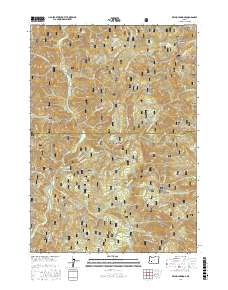
2017 Map of Reynolds Ridge
USGS Topo · Published 2017About this map
The Calapooya Mountains define the high-elevation divide along the border of Lane and Douglas counties, a landscape where the Willamette National Forest meets the Umpqua National Forest. This 2017 terrain study documents an intricate network of timber management infrastructure, including numerous timber sale (TS) designations like Bulldog TS, Delmonte TS, and Little Bend Cr TS. The area is characterized by prominent peaks and ridges, most notably Reynolds Ridge and Reynolds Butte, which overlook a complex drainage system fed by Steamboat Cr and Reynolds Cr. High-mountain meadows and plateaus such as Horse Prairie and Lost Camp Prairie break the dense forest cover. Significant water features include the secluded Bullpup Lake and several vital sources like Midnight Spring and Illahee Spring, which support the headwaters of the region's mountain creeks.
Find a feature on this map
63 named features on this map. Tap any name to fly to it.
Don’t see what you’re looking for? This feature index may not catch every label — zoom into the map to look around manually.
Map Details
Editions of this 2017 Reynolds Ridge Map
This is the sole edition of this map. No revisions or reprints were ever made.
Other maps of this area

1917 · Diamond Lake
USGS Topo · 1:125,000

1925 · Waldo Lake
USGS Topo · 1:125,000

1935 · Lowell
USGS Topo · 1:96,000

1942 · Lowell
USGS Topo · 1:125,000

1955 · Illahee Rock
USGS Topo · 1:62,500

1955 · Fairview Peak
USGS Topo · 1:62,500

1956 · Toketee Falls
USGS Topo · 1:62,500

1956 · Oakridge
USGS Topo · 1:62,500

1958 · Roseburg
USGS Topo · 1:250,000

1959 · Roseburg
USGS Topo · 1:250,000