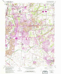
1964 Map of Reynoldsburg
USGS Topo · Published 1995About this map
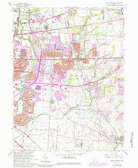
The eastern suburbs of Columbus are captured here during a period of significant expansion, where post-war residential growth begins to meet established rural communities. This landscape is anchored by the Port Columbus International Airport in the northwest, serving as a gateway to the region. The transition from industrial and urban centers like Whitehall and Columbus to the suburban character of Reynoldsburg is evident, with new housing developments appearing alongside older landmarks like the St Theresa Shrine.
Find a feature on this map
42 named features on this map. Tap any name to fly to it.
Don’t see what you’re looking for? This feature index may not catch every label — zoom into the map to look around manually.
Map Details
Editions of this 1964 Reynoldsburg Map
5 editions found
Other maps of this area

1902 · Westerville
USGS Topo · 1:62,500

1904 · Westerville
USGS Topo · 1:62,500

1907 · Thurston
USGS Topo · 1:62,500

1908 · Granville
USGS Topo · 1:62,500

1909 · Thurston
USGS Topo · 1:62,500

1910 · Granville
USGS Topo · 1:62,500

1925 · East Columbus
USGS Topo · 1:62,500

1943 · East Columbus
USGS Topo · 1:62,500

1947 · Columbus
USGS Topo · 1:250,000

1950 · Marion
USGS Topo · 1:250,000