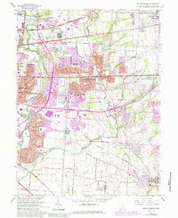
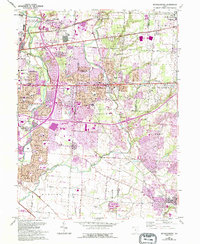
1964 Map of Reynoldsburg
USGS Topo · Published 1985About this map
Reynoldsburg and the eastern suburbs of Columbus appear here during a period of rapid post-war expansion. The landscape is defined by the transition from rural township lands to suburban neighborhoods, particularly evident in the dense clusters of new schools like Rose More Sch and Walnut Ridge Sch. Historically significant transportation routes, most notably the National Road, anchor the development patterns as residential subdivisions push eastward toward Licking Co.
Find a feature on this map
49 named features on this map. Tap any name to fly to it.
Don’t see what you’re looking for? This feature index may not catch every label — zoom into the map to look around manually.
Map Details
Editions of this 1964 Reynoldsburg Map
5 editions found
Other maps of this area

1902 · Westerville
USGS Topo · 1:62,500

1904 · Westerville
USGS Topo · 1:62,500

1907 · Thurston
USGS Topo · 1:62,500

1908 · Granville
USGS Topo · 1:62,500

1909 · Thurston
USGS Topo · 1:62,500

1910 · Granville
USGS Topo · 1:62,500

1925 · East Columbus
USGS Topo · 1:62,500

1943 · East Columbus
USGS Topo · 1:62,500

1947 · Columbus
USGS Topo · 1:250,000

1950 · Marion
USGS Topo · 1:250,000