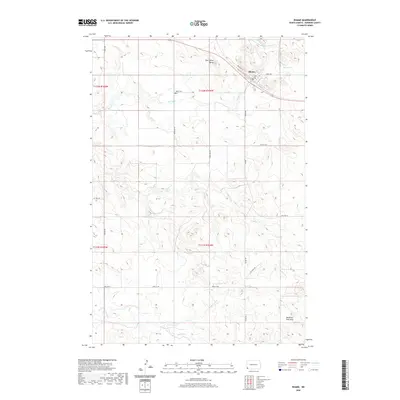
2020 Map of Rhame
USGS Topo · Published 2020About this map
Rhame serves as the primary hub in this corner of Bowman County, where the street grid includes locally significant routes like Railroad St and North Ave. The surrounding landscape is defined by the high ground of Post Office Butte to the northwest and the prominent Medicine Pole Hills rising in the southeast. This 2020 update documents the enduring rural infrastructure of the High Plains, from the isolated Tuttle Cem to the winding paths of Spring Cr and Coyote Cr. Modern resource extraction and transport are evident through features like Oil Well Rd and the path of Old Hwy 12, illustrating the intersection of historical cattle country and contemporary energy development.
Find a feature on this map
20 named features on this map. Tap any name to fly to it.
Don’t see what you’re looking for? This feature index may not catch every label — zoom into the map to look around manually.
Map Details
Editions of this 2020 Rhame Map
This is the sole edition of this map. No revisions or reprints were ever made.
Other maps of this area

1953 · Dickinson
USGS Topo · 1:250,000

1957 · Dickinson
USGS Topo · 1:250,000

1973 · Camel Butte
USGS Topo · 1:24,000
1973 · Rhame SE
USGS Topo · 1:24,000

1973 · Griffin
USGS Topo · 1:24,000

1973 · Cedar Hills
USGS Topo · 1:24,000
1973 · Mud Buttes
USGS Topo · 1:24,000

1973 · Rhame
USGS Topo · 1:24,000

1979 · Ives
USGS Topo · 1:24,000

1981 · Bowman
USGS Topo · 1:100,000