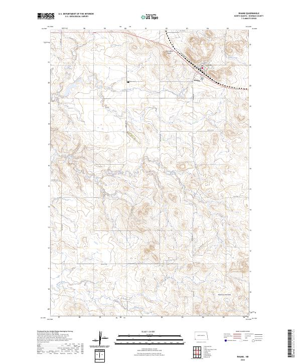
2024 Map of Rhame
USGS Topo · Published 2024About this map
Rhame sits along the northern edge of this southwestern North Dakota landscape, where the local street grid including Railroad St and North Ave meets the sweeping prairie. The town is flanked by notable landmarks like Post Office Butte to the northwest, a prominent local height of land. To the south, the terrain rises toward the Medicine Pole Hills, showing the distinctive drainage patterns of Coyote Creek and Spring Creek as they carve through the high plains.
Find a feature on this map
25 named features on this map. Tap any name to fly to it.
Don’t see what you’re looking for? This feature index may not catch every label — zoom into the map to look around manually.
Map Details
Editions of this 2024 Rhame Map
This is the sole edition of this map. No revisions or reprints were ever made.
Other maps of this area

1953 · Dickinson
USGS Topo · 1:250,000

1957 · Dickinson
USGS Topo · 1:250,000

1973 · Camel Butte
USGS Topo · 1:24,000
1973 · Rhame SE
USGS Topo · 1:24,000

1973 · Griffin
USGS Topo · 1:24,000

1973 · Cedar Hills
USGS Topo · 1:24,000
1973 · Mud Buttes
USGS Topo · 1:24,000

1973 · Rhame
USGS Topo · 1:24,000

1979 · Ives
USGS Topo · 1:24,000

1981 · Bowman
USGS Topo · 1:100,000