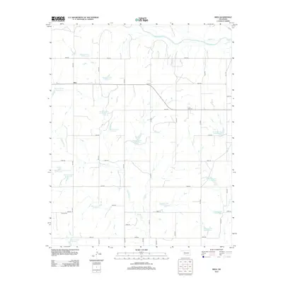
2012 Map of Rhea
USGS Topo · Published 2012About this map
Rhea is the central settlement in this Dewey County landscape, defined by an intricate network of water management sites along the Barnitz Creek drainage. This 2012 survey reveals a series of numbered reservoirs, such as Barnitz Cr Site 113 Reservoir and Barnitz Cr Site 40 Reservoir, which illustrate the localized hydraulic engineering common in the Oklahoma plains. The Canadian River flows along the northern edge of the map, fed by tributaries like Panther Cr and Dry Cr. This rural area is knit together by a regular grid of section roads including e0800 RD and n2130 RD. Cultural markers such as the Center Point Cem and German Cem serve as important touchstones for local genealogists, indicating the settlement patterns of the families who established farms near the forks of W Barnitz Cr.
Find a feature on this map
43 named features on this map. Tap any name to fly to it.
Don’t see what you’re looking for? This feature index may not catch every label — zoom into the map to look around manually.
Map Details
Editions of this 2012 Rhea Map
This is the sole edition of this map. No revisions or reprints were ever made.
Other maps of this area

1955 · Clinton
USGS Topo · 1:250,000

1957 · Clinton
USGS Topo · 1:250,000

1957 · Butler
USGS Topo · 1:62,500

1960 · Hammon
USGS Topo · 1:62,500

1961 · Leedey
USGS Topo · 1:62,500

1962 · Aledo
USGS Topo · 1:62,500

1976 · Butler NW
USGS Topo · 1:24,000

1976 · Butler NE
USGS Topo · 1:24,000
1983 · Anthon
USGS Topo · 1:24,000
1983 · Butler
USGS Topo · 1:24,000