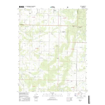
2017 Map of Rhea
USGS Topo · Published 2017About this map
Ozark National Forest covers the eastern portion of this Washington County landscape, defined by the prominent Weddington Mtn and Wedington Twin Mountains. This area of Northwest Arkansas is characterized by a mix of wooded highlands and agricultural clearings, with the community of Rhea and the Norwood Prairie settlement providing focal points for local history. Water is central to the geography here, from the larger Lake Weddington and Lincoln Lake to numerous named springs like Edison Spring and Roaring Spring. Genealogists will find several burial sites preserved on this sheet, including Norwood Cem, Beatty Cem, and Crawford Cem. The road network is heavily influenced by the terrain, with routes like Slate Gap Rd and Weddington Gap navigating the ridges, while the western reaches around Cincinnati Cr open into more accessible valley land.
Find a feature on this map
91 named features on this map. Tap any name to fly to it.
Don’t see what you’re looking for? This feature index may not catch every label — zoom into the map to look around manually.
Map Details
Editions of this 2017 Rhea Map
This is the sole edition of this map. No revisions or reprints were ever made.
Other maps of this area

1898 · Tahlequah
USGS Topo · 1:125,000

1898 · Winslow
USGS Topo · 1:125,000

1899 · Fayetteville
USGS Topo · 1:125,000

1899 · Siloam Springs
USGS Topo · 1:125,000

1901 · Winslow
USGS Topo · 1:125,000

1901 · Fayetteville
USGS Topo · 1:125,000

1901 · Tahlequah
USGS Topo · 1:125,000

1903 · Siloam Springs
USGS Topo · 1:125,000

1904 · Siloam Springs
USGS Topo · 1:125,000

1904 · Fayetteville
USGS Topo · 1:125,000