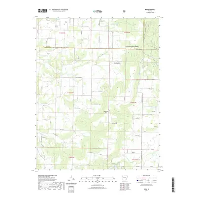
2020 Map of Rhea
USGS Topo · Published 2020About this map
Norwood Prairie and the community of Weddington occupy a landscape where the upland plateaus meet the timbered ridges of the Ozark National Forest. This modern record of Washington County shows a pattern of rural settlement defined by small cemeteries such as Beatty Cem and Mateer Cem, alongside the headwaters of Cincinnati Cr and Moores Cr. The transition from the open fields of Williams Field to the high points of Weddington Mtn and the Weddington Twin Mountains illustrates the varied topography west of the Fayetteville area. Recreational and natural resources are central to the region, anchored by Lake Weddington and the smaller Double Bar Ranch Lake. The settlement of Rhea and the high ground at Roundtop further define the local geography, connected by a network of rural roads like N Wedington Blacktop Rd that bridge the gaps between historic family homesteads and protected forest lands.
Find a feature on this map
86 named features on this map. Tap any name to fly to it.
Don’t see what you’re looking for? This feature index may not catch every label — zoom into the map to look around manually.
Map Details
Editions of this 2020 Rhea Map
This is the sole edition of this map. No revisions or reprints were ever made.
Other maps of this area

1898 · Tahlequah
USGS Topo · 1:125,000

1898 · Winslow
USGS Topo · 1:125,000

1899 · Fayetteville
USGS Topo · 1:125,000

1899 · Siloam Springs
USGS Topo · 1:125,000

1901 · Winslow
USGS Topo · 1:125,000

1901 · Fayetteville
USGS Topo · 1:125,000

1901 · Tahlequah
USGS Topo · 1:125,000

1903 · Siloam Springs
USGS Topo · 1:125,000

1904 · Siloam Springs
USGS Topo · 1:125,000

1904 · Fayetteville
USGS Topo · 1:125,000