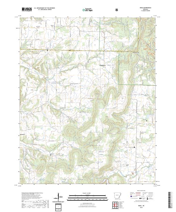
2024 Map of Rhea
USGS Topo · Published 2024About this map
Weddington Mtn and the northern reaches of the Ozark National Forest dominate the central landscape of this western Washington County survey. The terrain transitions from the elevated heights of Bell Mtn and Roundtop into the fertile drainage basins of Cincinnati Creek and Moores Creek. Small, dispersed settlements like Cincinnati, Weddington, and Rhea serve as anchors for a rural community connected by a network of county roads. Genealogical interest is particularly high due to the presence of several family and community burial sites, including Norwood Cem, Beatty Cem, and Mateer Cem. The map reveals a land defined by its hydrology, where Lincoln Lake and various branches like Beatty Branch and Funkhouser Branch carve through the foothills. Further north, the agricultural character is evident at Norwood Prairie and the private Hoerler Farms Airport.
Find a feature on this map
92 named features on this map. Tap any name to fly to it.
Don’t see what you’re looking for? This feature index may not catch every label — zoom into the map to look around manually.
Map Details
Editions of this 2024 Rhea Map
This is the sole edition of this map. No revisions or reprints were ever made.
Other maps of this area

1898 · Tahlequah
USGS Topo · 1:125,000

1898 · Winslow
USGS Topo · 1:125,000

1899 · Fayetteville
USGS Topo · 1:125,000

1899 · Siloam Springs
USGS Topo · 1:125,000

1901 · Winslow
USGS Topo · 1:125,000

1901 · Fayetteville
USGS Topo · 1:125,000

1901 · Tahlequah
USGS Topo · 1:125,000

1903 · Siloam Springs
USGS Topo · 1:125,000

1904 · Siloam Springs
USGS Topo · 1:125,000

1904 · Fayetteville
USGS Topo · 1:125,000