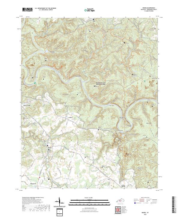
2022 Map of Rhoda
USGS Topo · Published 2022About this map
Mammoth Cave National Park dominates the northern and eastern portions of this map, revealing a landscape defined by its complex subterranean drainage. The Green River meanders through the center of the sheet, creating prominent features like Turnhole Bend, Sand Cave Island, and Boardcut Island. This area is characterized by karst topography, where surface water often disappears into the ground, as seen in the numerous sinks and hollows such as Double Sinks, Cedar Sink, and Smith Valley.
Find a feature on this map
132 named features on this map. Tap any name to fly to it.
Don’t see what you’re looking for? This feature index may not catch every label — zoom into the map to look around manually.
Map Details
Editions of this 2022 Rhoda Map
This is the sole edition of this map. No revisions or reprints were ever made.
Other maps of this area

1922 · Leitchfield
USGS Topo · 1:48,000

1922 · Brownsville
USGS Topo · 1:62,500

1922 · Mammoth Cave
USGS Topo · 1:62,500

1923 · Mammoth Cave
USGS Topo · 1:62,500

1923 · Brownsville
USGS Topo · 1:62,500

1925 · Cub Run
USGS Topo · 1:62,500

1925 · Leitchfield
USGS Topo · 1:62,500

1953 · Bee Spring
USGS Topo · 1:24,000

1954 · Evansville
USGS Topo · 1:250,000
1954 · Dickeys Mills
USGS Topo · 1:24,000