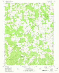
1981 Map of Rhyse
USGS Topo · Published 1982About this map
Rhyse serves as a small focal point within this landscape of the Missouri Ozarks, situated near the intersection of several branching drainages. The topography is defined by deeply carved hollows, including Fudge Hollow, Grave Hollow, and Coon Den Hollow, which reveal a traditional pattern of upland settlement where homes and cemeteries often occupy the ridges or protected valley floors. Numerous small family or community burial grounds like Wofford Cem and Dry Fork Cem are scattered throughout the hills, reflecting a deeply rooted local history.
Find a feature on this map
53 named features on this map. Tap any name to fly to it.
Don’t see what you’re looking for? This feature index may not catch every label — zoom into the map to look around manually.
Map Details
Editions of this 1981 Rhyse Map
This is the sole edition of this map. No revisions or reprints were ever made.
Other maps of this area

1932 · Cedar Grove
USGS Topo · 1:48,000

1937 · Edgar Springs
USGS Topo · 1:48,000

1941 · Salem
USGS Topo · 1:62,500

1945 · Salem
USGS Topo · 1:62,500

1945 · Edgar Springs
USGS Topo · 1:62,500

1949 · Rolla
USGS Topo · 1:250,000

1951 · Montauk
USGS Topo · 1:24,000

1951 · Licking
USGS Topo · 1:24,000

1951 · Cedargrove
USGS Topo · 1:24,000

1951 · Raymondville
USGS Topo · 1:62,500