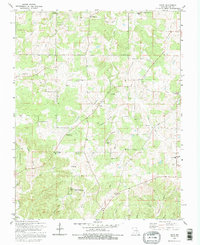
1992 Map of Rhyse
USGS Topo · Published 1995About this map
Rhyse and the surrounding Dent County landscape are defined by a complex network of narrow hollows and winding creek beds, as shown in this late 20th-century survey. The settlement pattern is largely rural and dispersed, anchored by family-named landmarks and local congregations like Mt Hermon Ch and New Harmony Ch. A significant portion of the southwestern quadrant is dedicated to the Montauk State Public Hunting Area, where the Lookout Tower Zion stands as a prominent topographical feature. Local genealogy is well-documented through numerous burial sites including Robnett Cem, Campbell Cem, and Wallace Cem. The map tracks the movement of water from Skiles Spring through various drainages such as Barnitz Creek and Humes Creek, illustrating a rugged Ozark terrain where roads often follow the high ridges or parallel the creek beds.
Find a feature on this map
43 named features on this map. Tap any name to fly to it.
Don’t see what you’re looking for? This feature index may not catch every label — zoom into the map to look around manually.
Map Details
Editions of this 1992 Rhyse Map
This is the sole edition of this map. No revisions or reprints were ever made.
Other maps of this area

1932 · Cedar Grove
USGS Topo · 1:48,000

1937 · Edgar Springs
USGS Topo · 1:48,000

1941 · Salem
USGS Topo · 1:62,500

1945 · Salem
USGS Topo · 1:62,500

1945 · Edgar Springs
USGS Topo · 1:62,500

1949 · Rolla
USGS Topo · 1:250,000

1951 · Montauk
USGS Topo · 1:24,000

1951 · Licking
USGS Topo · 1:24,000

1951 · Cedargrove
USGS Topo · 1:24,000

1951 · Raymondville
USGS Topo · 1:62,500