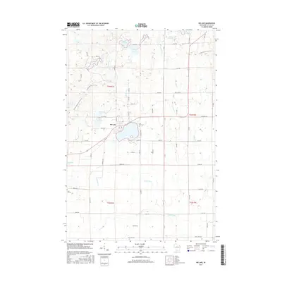
2015 Map of Rib Lake
USGS Topo · Published 2015About this map
The village of Rib Lake serves as the central hub of this north-central Wisconsin landscape, situated along the shores of its namesake Rib Lake and Little Rib Lake. The topography is defined by its glacial heritage, featuring a dense network of kettle lakes and meandering waterways including North Harper Lake, South Harper Lake, and the upper reaches of the Big Rib River. This glacial legacy is further emphasized by the winding route of the Ice Age National Scenic Trail, which traverses the northern and western portions of the quadrangle through wooded sections near Kennedy Lake. Local heritage is anchored by sites like Lake View Cemetery on the eastern shore of the main lake and Saint Ann Cemetery to the southwest, while the rural road network, including Rustic Road, reflects the area's timber and recreational history. The map captures a well-established community where the town's geometry meets the irregular drainage patterns of Silbernagel Creek and Sheep Ranch Creek.
Find a feature on this map
71 named features on this map. Tap any name to fly to it.
Don’t see what you’re looking for? This feature index may not catch every label — zoom into the map to look around manually.
Map Details
Editions of this 2015 Rib Lake Map
This is the sole edition of this map. No revisions or reprints were ever made.
Other maps of this area

1902 · Marathon
USGS Topo · 1:125,000

1944 · Ogema
USGS Topo · 1:48,000

1945 · Rib Lake
USGS Topo · 1:48,000

1947 · Rib Lake
USGS Topo · 1:48,000

1947 · Ogema
USGS Topo · 1:48,000

1949 · Ogema
USGS Topo · 1:48,000

1949 · Rib Lake
USGS Topo · 1:48,000

1951 · Athens
USGS Topo · 1:48,000

1951 · Medford
USGS Topo · 1:48,000

1953 · Rice Lake
USGS Topo · 1:250,000