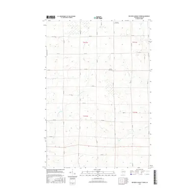
2015 Map of Rib River Lookout Tower
USGS Topo · Published 2015About this map
Rib River Lookout Tower stands as a prominent geographic landmark in this Taylor County landscape, overlooking a network of tributary streams and rural corridors. The terrain is defined by a complex drainage system, including the E Br Little Black River and the winding paths of Joe Martin Cr, Mink Cr, and Coffee Cr. These waterways dictate the local geography, punctuated by a small Reservoir and the historic Saint Peters Lutheran Cem situated near the northern boundary.
Find a feature on this map
36 named features on this map. Tap any name to fly to it.
Don’t see what you’re looking for? This feature index may not catch every label — zoom into the map to look around manually.
Map Details
Editions of this 2015 Rib River Lookout Tower Map
This is the sole edition of this map. No revisions or reprints were ever made.
Other maps of this area

1902 · Marathon
USGS Topo · 1:125,000

1944 · Ogema
USGS Topo · 1:48,000

1945 · Rib Lake
USGS Topo · 1:48,000

1947 · Rib Lake
USGS Topo · 1:48,000

1947 · Ogema
USGS Topo · 1:48,000

1949 · Ogema
USGS Topo · 1:48,000

1949 · Rib Lake
USGS Topo · 1:48,000

1951 · Athens
USGS Topo · 1:48,000

1951 · Medford
USGS Topo · 1:48,000

1953 · Rice Lake
USGS Topo · 1:250,000