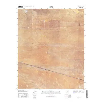
2017 Map of Ricardo
USGS Topo · Published 2017About this map
Evanola and the expansive ranching country of eastern New Mexico define this quadrangle. The landscape is structured by a network of sectional boundaries, including t3n r23e and t2n r24e, which reflect the historic Public Land Survey System layout. Transportation in the region relies on the prominent corridor of Us 60, while the Ricardo rail line runs parallel through the southern portion of the sheet. For genealogists and local historians, several small landmarks offer a connection to the area's early residents, specifically the Morris Cem and the Ricardo Cem. The terrain is mostly open and traversed by county roads such as Co RD 1-25 and the aptly named Ricardo Rd, showing a quiet rural community focused on the intersection of the railway and regional highway infrastructure.
Find a feature on this map
13 named features on this map. Tap any name to fly to it.
Don’t see what you’re looking for? This feature index may not catch every label — zoom into the map to look around manually.
Map Details
Editions of this 2017 Ricardo Map
This is the sole edition of this map. No revisions or reprints were ever made.
Other maps of this area

1954 · Fort Sumner
USGS Topo · 1:250,000

1958 · Fort Sumner
USGS Topo · 1:250,000

1965 · Fort Sumner West
USGS Topo · 1:24,000

1965 · Windmill Draw
USGS Topo · 1:24,000

1966 · West Camp
USGS Topo · 1:24,000

1966 · Alamo Ranch
USGS Topo · 1:24,000

1966 · Ricardo
USGS Topo · 1:24,000

1966 · Alamogordo Dam
USGS Topo · 1:24,000

1966 · Cooper Ranch
USGS Topo · 1:24,000

1966 · Horney Ranch
USGS Topo · 1:24,000