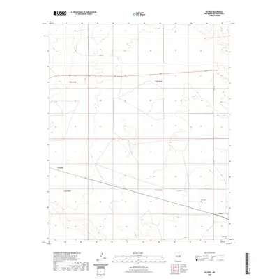
2020 Map of Ricardo
USGS Topo · Published 2020About this map
Evanola marks the northwestern corner of this De Baca County landscape, a region defined by its wide open spaces and straight-line road network. The mapping reflects a high-plains environment where infrastructure is sparse and focused on long-distance transit. For genealogists and local historians, the sheet preserves the location of two significant burial sites: the Morris Cem and the Ricardo Cem in the southeastern quadrant. These features, along with names like Ricardo Rd, suggest the area's agricultural and ranching history. The terrain is largely organized by the Public Land Survey System, as seen in the grid boundaries of t3n r23e and t2n r24e. Primary travel through the area follows local routes such as Co Rd 1-25 and Co Rd 1-20, which navigate a landscape of subtle elevation changes and seasonal wetlands.
Find a feature on this map
11 named features on this map. Tap any name to fly to it.
Don’t see what you’re looking for? This feature index may not catch every label — zoom into the map to look around manually.
Map Details
Editions of this 2020 Ricardo Map
This is the sole edition of this map. No revisions or reprints were ever made.
Other maps of this area

1954 · Fort Sumner
USGS Topo · 1:250,000

1958 · Fort Sumner
USGS Topo · 1:250,000

1965 · Fort Sumner West
USGS Topo · 1:24,000

1965 · Windmill Draw
USGS Topo · 1:24,000

1966 · West Camp
USGS Topo · 1:24,000

1966 · Alamo Ranch
USGS Topo · 1:24,000

1966 · Ricardo
USGS Topo · 1:24,000

1966 · Alamogordo Dam
USGS Topo · 1:24,000

1966 · Cooper Ranch
USGS Topo · 1:24,000

1966 · Horney Ranch
USGS Topo · 1:24,000