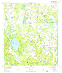
1949 Map of Rice Creek
USGS Topo · Published 1972About this map
Georges Lake dominates the southwest portion of this landscape at the boundary between Clay and Putnam counties. The map reflects a period of transition, with original 1940s topography updated via 1970 photorevisions to show emerging road networks and structural developments. Drainage patterns are well-defined by the winding course of Rice Creek and its convergence with Etonia Creek in the south, while Greens Creek cuts through the northern timberlands. The terrain is characterized by intricate wetlands and low-lying drainages like Devils Den Cr and Falling Branch, which indicate the hydraulic complexity of this North Florida region before modern large-scale residential expansion reshaped the local environment.
Find a feature on this map
8 named features on this map. Tap any name to fly to it.
Don’t see what you’re looking for? This feature index may not catch every label — zoom into the map to look around manually.
Map Details
Editions of this 1949 Rice Creek Map
3 editions found
Other maps of this area

1912 · Palatka
USGS Topo · 1:48,000

1915 · Palatka
USGS Topo · 1:62,500

1915 · Interlachen
USGS Topo · 1:48,000

1916 · Interlachen
USGS Topo · 1:62,500

1942 · Ates Creek
USGS Topo · 1:62,500

1944 · Interlachen
USGS Topo · 1:62,500

1947 · Bostwick
USGS Topo · 1:50,000

1949 · Rice Creek
USGS Topo · 1:24,000

1949 · Bostwick
USGS Topo · 1:24,000

1949 · Green Cove Springs
USGS Topo · 1:24,000