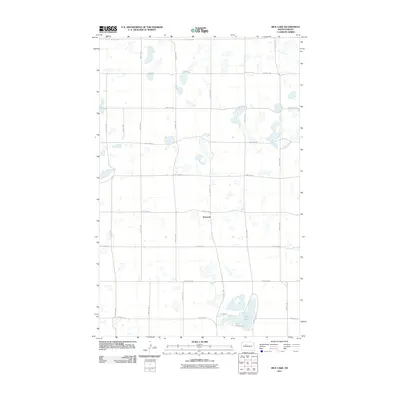
2011 Map of Rice Lake
USGS Topo · Published 2011About this map
Hesnault sits at the heart of this prairie landscape, where the township and range survey system has left a distinct grid of section-line roads. This network, defined by routes such as 177th Ave SW and 170th St SW, reveals a pattern of agricultural land division typical of the Great Plains. The hydrology of the area is characterized by numerous small potholes and depressions, with the most significant being Rice Lake in the southeast. Circled by N Rice Lake Rd and S Rice Lake Rd, this water body provides a central landmark for the surrounding rural community. The map's detailed documentation of rural addresses and unpaved section-line trails reflects the modern organization of Ward County's agricultural interior.
Find a feature on this map
20 named features on this map. Tap any name to fly to it.
Don’t see what you’re looking for? This feature index may not catch every label — zoom into the map to look around manually.
Map Details
Editions of this 2011 Rice Lake Map
This is the sole edition of this map. No revisions or reprints were ever made.
Other maps of this area

1928 · Minot
USGS Topo · 1:62,500

1948 · Minot NW
USGS Topo · 1:24,000

1949 · Minot NW
USGS Topo · 1:24,000

1954 · Minot
USGS Topo · 1:250,000

1954 · McClusky
USGS Topo · 1:250,000

1958 · McClusky
USGS Topo · 1:250,000

1958 · Minot
USGS Topo · 1:250,000

1980 · Minot
USGS Topo · 1:100,000

1980 · Lake Vernon
USGS Topo · 1:24,000

1980 · Rice Lake NW
USGS Topo · 1:24,000