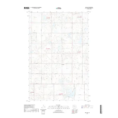
2017 Map of Rice Lake
USGS Topo · Published 2017About this map
Hesnault sits at the center of this Ward County landscape, where the prairie is defined by a dense network of small wetlands and potholes typical of the North Dakota drift plain. The terrain is marked by a grid of rural roads, including 170th St SW and 205th Ave SW, which navigate around numerous unnamed water bodies. To the south, the namesake Rice Lake is accessed via N Rice Lake Rd and S Rice Lake Rd, serving as a primary geographic anchor for the region. In the northwest, Mellem Lake provides another significant landmark amidst the agricultural sections. This 2017 survey reflects the enduring section-line road system that has organized this territory since the original land surveys, connecting scattered farmsteads via routes like Co Hwy 20 and Co Hwy 13.
Find a feature on this map
24 named features on this map. Tap any name to fly to it.
Don’t see what you’re looking for? This feature index may not catch every label — zoom into the map to look around manually.
Map Details
Editions of this 2017 Rice Lake Map
This is the sole edition of this map. No revisions or reprints were ever made.
Other maps of this area

1928 · Minot
USGS Topo · 1:62,500

1948 · Minot NW
USGS Topo · 1:24,000

1949 · Minot NW
USGS Topo · 1:24,000

1954 · Minot
USGS Topo · 1:250,000

1954 · McClusky
USGS Topo · 1:250,000

1958 · McClusky
USGS Topo · 1:250,000

1958 · Minot
USGS Topo · 1:250,000

1980 · Minot
USGS Topo · 1:100,000

1980 · Lake Vernon
USGS Topo · 1:24,000

1980 · Rice Lake NW
USGS Topo · 1:24,000