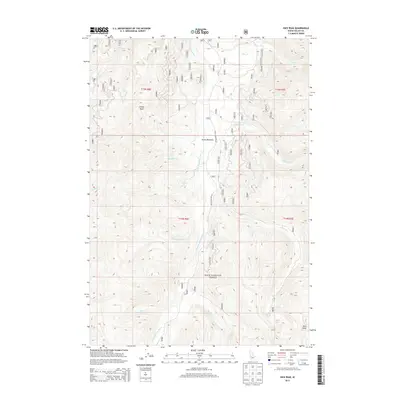
2013 Map of Rice Peak
USGS Topo · Published 2013About this map
Vulcan Hot Springs and the headwaters of the S Fork Salmon River dominate this high-elevation landscape within the Boise National Forest. The 2013 survey illustrates a wilderness defined by its drainage basins, where water flows from the heights of Rice Peak through Rice Cr and Cupp Cr. Central to the area is Stolle Meadows, a notable flat clearing accessed by Stolle Meadows Rd and bordered by Lodgepole Cr. The map's detail provides a specialized look at the forest's internal road system, including numbered tracks like 474 and 471, which service the remote terrain around Cougar Rock. This documentation reflects the modern management of these Idaho backcountry resources, showing the relationship between thermal features, alpine lakes like Rice Lake, and the surrounding peaks.
Find a feature on this map
64 named features on this map. Tap any name to fly to it.
Don’t see what you’re looking for? This feature index may not catch every label — zoom into the map to look around manually.
Map Details
Editions of this 2013 Rice Peak Map
This is the sole edition of this map. No revisions or reprints were ever made.
Other maps of this area

1909 · Garden Valley
USGS Topo · 1:125,000

1953 · Boiling Springs
USGS Topo · 1:62,500

1953 · Deadwood Reservoir
USGS Topo · 1:62,500

1954 · Gold Fork
USGS Topo · 1:62,500

1954 · Warm Lake
USGS Topo · 1:62,500

1957 · Challis
USGS Topo · 1:250,000

1960 · Challis
USGS Topo · 1:250,000

1963 · Challis
USGS Topo · 1:250,000

1982 · Pistol Creek
USGS Topo · 1:100,000

1982 · Deadwood River
USGS Topo · 1:100,000