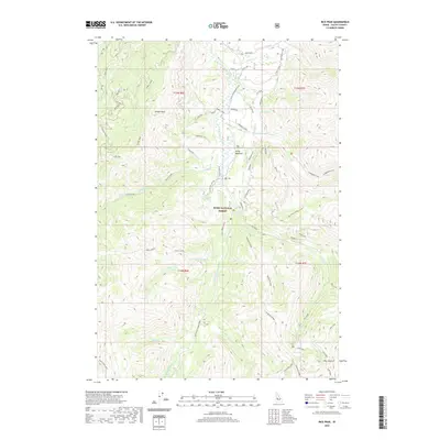
2020 Map of Rice Peak
USGS Topo · Published 2020About this map
Vulcan Hot Springs and the headwaters of the South Fork Salmon River define this high-elevation portion of the Boise National Forest in Valley County. The geography is dominated by a complex network of ridges and drainages, including Telephone Ridge and Blue Point Ridge, which divide the many creeks feeding the Salmon River system. The presence of Stolle Meadows provides a distinct break in the steep topography, while the southeastern corner is anchored by the prominent Rice Peak and its namesake Rice Lake. This area is characterized by its isolation and limited access, with several forest spurs such as Spur 483A and the Cup Corral Cutoff marking the few established routes through the timbered landscape. The map reveals a land utilized for natural resource management and backcountry recreation, from the quiet waters of Long Lake to the thermal activity at the hot springs.
Find a feature on this map
51 named features on this map. Tap any name to fly to it.
Don’t see what you’re looking for? This feature index may not catch every label — zoom into the map to look around manually.
Map Details
Editions of this 2020 Rice Peak Map
This is the sole edition of this map. No revisions or reprints were ever made.
Other maps of this area

1909 · Garden Valley
USGS Topo · 1:125,000

1953 · Boiling Springs
USGS Topo · 1:62,500

1953 · Deadwood Reservoir
USGS Topo · 1:62,500

1954 · Gold Fork
USGS Topo · 1:62,500

1954 · Warm Lake
USGS Topo · 1:62,500

1957 · Challis
USGS Topo · 1:250,000

1960 · Challis
USGS Topo · 1:250,000

1963 · Challis
USGS Topo · 1:250,000

1982 · Pistol Creek
USGS Topo · 1:100,000

1982 · Deadwood River
USGS Topo · 1:100,000