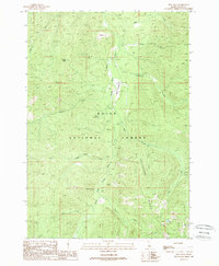
1988 Map of Rice Peak
USGS Topo · Published 1988About this map
The South Fork Salmon River carves through this portion of the Boise National Forest, defining a landscape where geothermal features and mineral extraction meet. Near the center of the sheet, Vulcan Hot Springs emerges near the riverbanks, while the presence of the Eureka Silver King Mine to the south points to the region's history of silver prospecting. The terrain is marked by high elevations like Rice Peak and prominent features such as Cougar Rock and Lodgepole.
Find a feature on this map
20 named features on this map. Tap any name to fly to it.
Don’t see what you’re looking for? This feature index may not catch every label — zoom into the map to look around manually.
Map Details
Editions of this 1988 Rice Peak Map
This is the sole edition of this map. No revisions or reprints were ever made.
Other maps of this area

1909 · Garden Valley
USGS Topo · 1:125,000

1953 · Boiling Springs
USGS Topo · 1:62,500

1953 · Deadwood Reservoir
USGS Topo · 1:62,500

1954 · Gold Fork
USGS Topo · 1:62,500

1954 · Warm Lake
USGS Topo · 1:62,500

1957 · Challis
USGS Topo · 1:250,000

1960 · Challis
USGS Topo · 1:250,000

1963 · Challis
USGS Topo · 1:250,000

1982 · Pistol Creek
USGS Topo · 1:100,000

1982 · Deadwood River
USGS Topo · 1:100,000