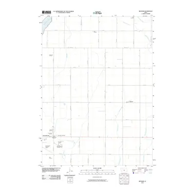
2010 Map of Richard
USGS Topo · Published 2010About this map
Rockwell City and its surrounding agricultural township are the primary focus of this late-2000s study, which highlights a landscape of rectilinear section lines and scattered rural burial grounds. The presence of the Iowa State Reformatory for Women and its associated Reformatory Cemetery on the edge of town provides a specific look at the institutional footprint in Calhoun County. To the east, the settlement of Richard sits near the winding course of Purgatory Creek, while the northwestern corner is defined by the shoreline of North Twin Lake. Family and community history is anchored by numerous plots including Hope Cemetery, Rosehill Cemetery, and Saint Francis Cemetery, marking the enduring heritage of this central Iowa prairie region. The drainage patterns of Lake Creek and West Cedar Creek offer a natural contrast to the rigid grid of county roads such as Ralston Ave and 210th St.
Find a feature on this map
39 named features on this map. Tap any name to fly to it.
Don’t see what you’re looking for? This feature index may not catch every label — zoom into the map to look around manually.
Map Details
Editions of this 2010 Richard Map
This is the sole edition of this map. No revisions or reprints were ever made.
Other maps of this area

1954 · Fort Dodge
USGS Topo · 1:250,000

1957 · Fort Dodge
USGS Topo · 1:250,000

1958 · Fort Dodge
USGS Topo · 1:250,000

1965 · Farnhamville
USGS Topo · 1:24,000

1965 · Knierim
USGS Topo · 1:24,000

1979 · Gilmore City SW
USGS Topo · 1:24,000

1979 · Manson
USGS Topo · 1:24,000

1979 · Pomeroy
USGS Topo · 1:24,000

1980 · Rockwell City
USGS Topo · 1:24,000
1980 · Richard
USGS Topo · 1:24,000