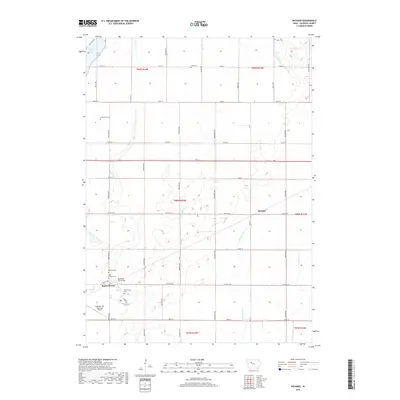
2018 Map of Richard
USGS Topo · Published 2018About this map
Rockwell City anchors the southwestern corner of this survey, a hub of infrastructure and agriculture in Calhoun County. The landscape is defined by its meticulous grid of roads, such as CO Hwy D36 and CO Hwy D33, which connect the rural settlement of Richard to the surrounding township sections. The northern edge of the map features the shoreline of North Twin Lake, while the interior is drained by a complex network of waterways, including Purgatory Cr, Lake Cr, and several engineered channels like Drainage Ditch 13.
Find a feature on this map
46 named features on this map. Tap any name to fly to it.
Don’t see what you’re looking for? This feature index may not catch every label — zoom into the map to look around manually.
Map Details
Editions of this 2018 Richard Map
This is the sole edition of this map. No revisions or reprints were ever made.
Other maps of this area

1954 · Fort Dodge
USGS Topo · 1:250,000

1957 · Fort Dodge
USGS Topo · 1:250,000

1958 · Fort Dodge
USGS Topo · 1:250,000

1965 · Farnhamville
USGS Topo · 1:24,000

1965 · Knierim
USGS Topo · 1:24,000

1979 · Gilmore City SW
USGS Topo · 1:24,000

1979 · Manson
USGS Topo · 1:24,000

1979 · Pomeroy
USGS Topo · 1:24,000

1980 · Rockwell City
USGS Topo · 1:24,000
1980 · Richard
USGS Topo · 1:24,000