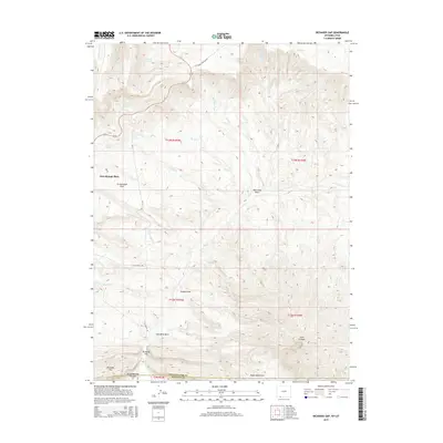
2015 Map of Richards Gap
USGS Topo · Published 2015About this map
Greenhough Place sits at the heart of this high-altitude landscape along the border of Sweetwater County, Wyoming, and Daggett County, Utah. The terrain is defined by a series of dramatic draws and canyons, most notably Coal Mine Draw and Scott Canyon, which cut through the ridges of Richards Mtn and the Tepee Mountains. Water sources are critical features in this arid environment, marked by numerous named springs such as Castello Spring, Ely Spring, and Brown Spring. These water points, along with Greenhough Flats, suggest a landscape historically utilized for livestock grazing or resource extraction, connected by primitive routes like Clay Basin Pipeline Rd. The map detail captures the remote geography of Richards Gap before modern developments, preserving the nomenclature of the local ranchers and early surveyors.
Find a feature on this map
35 named features on this map. Tap any name to fly to it.
Don’t see what you’re looking for? This feature index may not catch every label — zoom into the map to look around manually.
Map Details
Editions of this 2015 Richards Gap Map
This is the sole edition of this map. No revisions or reprints were ever made.
Other maps of this area

1885 · Ashley
USGS Topo · 1:250,000

1952 · Willow Creek Butte
USGS Topo · 1:24,000

1952 · Clay Basin
USGS Topo · 1:24,000

1952 · Goslin Mtn
USGS Topo · 1:24,000

1954 · Vernal
USGS Topo · 1:250,000

1954 · Rock Springs
USGS Topo · 1:250,000

1957 · Currant Creek Ranch
USGS Topo · 1:62,500

1958 · Vernal
USGS Topo · 1:250,000

1958 · Rock Springs
USGS Topo · 1:250,000

1960 · Vernal
USGS Topo · 1:250,000