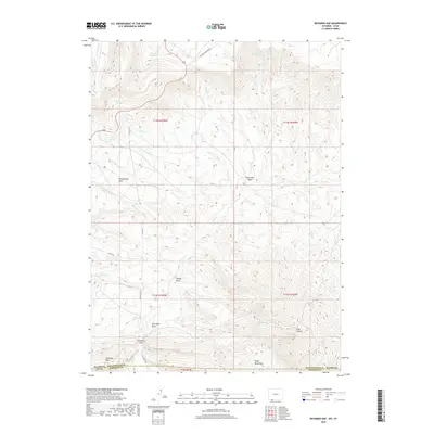
2018 Map of Richards Gap
USGS Topo · Published 2018About this map
Richards Gap serves as a prominent geographic waypoint in this corner of the Wyoming-Utah borderlands. The landscape is defined by its industrial and ranching history, evidenced by Coal Mine Draw and various spring-fed landmarks such as Castello Spring and Brown Spring. Moving through the high-elevation terrain, the map details the wide expanse of Greenhough Flats and the enclosed Red Creek Basin, where numerous drainages like Beef Steer Cr and Snow Cr collect. To the south, the Tepee Mountains and Richards Mtn rise above the basin floor. The network of primitive roads, including Clay Basin Rd and Clay Basin Pipeline Rd, illustrates how this isolated region is utilized for resource extraction and livestock management, with the Trough Draw cutting through the center of the survey area.
Find a feature on this map
36 named features on this map. Tap any name to fly to it.
Don’t see what you’re looking for? This feature index may not catch every label — zoom into the map to look around manually.
Map Details
Editions of this 2018 Richards Gap Map
This is the sole edition of this map. No revisions or reprints were ever made.
Other maps of this area

1885 · Ashley
USGS Topo · 1:250,000

1952 · Willow Creek Butte
USGS Topo · 1:24,000

1952 · Clay Basin
USGS Topo · 1:24,000

1952 · Goslin Mtn
USGS Topo · 1:24,000

1954 · Vernal
USGS Topo · 1:250,000

1954 · Rock Springs
USGS Topo · 1:250,000

1957 · Currant Creek Ranch
USGS Topo · 1:62,500

1958 · Vernal
USGS Topo · 1:250,000

1958 · Rock Springs
USGS Topo · 1:250,000

1960 · Vernal
USGS Topo · 1:250,000