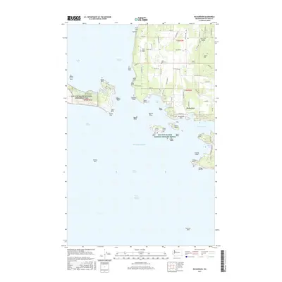
2017 Map of Richardson
USGS Topo · Published 2017About this map
Lopez Island Airport and the surrounding rural infrastructure of the San Juan archipelago anchor this 2017 study of the island's southern reach. The settlement of Richardson sits at the junction of Richardson RD and Hodgson RD, overlooking Jones Bay. The landscape is a mix of protected lands and private homesteads, with the San Juan Island National Historical Park occupying the western peninsula near Mt Finlayson.
Find a feature on this map
96 named features on this map. Tap any name to fly to it.
Don’t see what you’re looking for? This feature index may not catch every label — zoom into the map to look around manually.
Map Details
Editions of this 2017 Richardson Map
This is the sole edition of this map. No revisions or reprints were ever made.
Other maps of this area

1943 · Richardson
USGS Topo · 1:62,500

1943 · Orcas Island
USGS Topo · 1:62,500

1954 · Friday Harbor
USGS Topo · 1:24,000

1954 · False Bay
USGS Topo · 1:24,000

1957 · Richardson
USGS Topo · 1:62,500

1957 · Orcas Island
USGS Topo · 1:62,500

1957 · Victoria
USGS Topo · 1:250,000
1973 · Lopez Pass
USGS Topo · 1:24,000

1973 · Shaw Island
USGS Topo · 1:24,000
1973 · Blakely Island
USGS Topo · 1:24,000