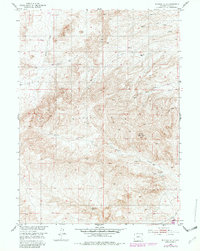
1953 Map of Richeau Hills
USGS Topo · Published 1982About this map
Richeau Hills dominate this high-plains landscape in Platte County, Wyoming, revealing a rugged ranching territory mapped just after the mid-century. The map details the intricate drainage systems that define this arid environment, including the headwaters of Brush Creek and North Richeau Creek. Settlement is sparse and focused on water sources, anchored by the Hill Ranch and the vital Home Ranch Spring. These small outposts represent the isolated nature of Wyoming cattle operations during this era, where survival depended on the geography of springs and creeks like Maxwell Creek and South Hunton Creek. The topography also highlights prominent landmarks such as Squaw Hill, which provided significant orientation points for early surveyors and travelers navigating between these remote ranch sites.
Find a feature on this map
9 named features on this map. Tap any name to fly to it.
Don’t see what you’re looking for? This feature index may not catch every label — zoom into the map to look around manually.
Map Details
Editions of this 1953 Richeau Hills Map
2 editions found
Other maps of this area

1953 · Natwick SW
USGS Topo · 1:24,000

1953 · Double L Ranch
USGS Topo · 1:24,000

1953 · Natwick
USGS Topo · 1:24,000

1953 · Squaw Rock
USGS Topo · 1:24,000

1953 · Ferguson Corner
USGS Topo · 1:24,000

1953 · Richeau Hills
USGS Topo · 1:24,000

1954 · Cheyenne
USGS Topo · 1:250,000

1958 · Cheyenne
USGS Topo · 1:250,000

1962 · Delano Ranch
USGS Topo · 1:24,000

1962 · Mc Donald Ranch
USGS Topo · 1:24,000