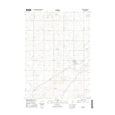
2017 Map of Richfield
USGS Topo · Published 2017About this map
Richfield serves as the central hub of this high desert landscape, situated at the confluence of an intricate irrigation network and the Little Wood River. The town's grid is bounded by W Cassia Ave and E Nez Perce St, reflecting a community deeply tied to the surrounding agricultural plains. The terrain is defined by the contrast between volcanic features like Johnson Butte and the extensive water management infrastructure designed to reclaim the arid soil. A dense system of canals, including the West Main Canal and the Dietrich Main Canal, snakes across the quadrangle alongside numerous numbered laterals such as Lateral 1096A and Lateral 444. This network of man-made waterways, paired with natural drainage like Cottonwood Slough and Jim Burns Slough, illustrates the vital engineering required to sustain Idaho's Snake River Plain settlements.
Find a feature on this map
58 named features on this map. Tap any name to fly to it.
Don’t see what you’re looking for? This feature index may not catch every label — zoom into the map to look around manually.
Map Details
Editions of this 2017 Richfield Map
This is the sole edition of this map. No revisions or reprints were ever made.
Other maps of this area

1955 · Twin Falls
USGS Topo · 1:250,000

1955 · Hailey
USGS Topo · 1:250,000

1958 · Twin Falls
USGS Topo · 1:250,000

1959 · Hailey
USGS Topo · 1:250,000

1962 · Hailey
USGS Topo · 1:250,000

1971 · Owinza
USGS Topo · 1:24,000

1971 · Dietrich
USGS Topo · 1:24,000

1971 · Dietrich Butte
USGS Topo · 1:24,000
1979 · Richfield
USGS Topo · 1:24,000

1979 · Shoshone Ice Cave
USGS Topo · 1:24,000