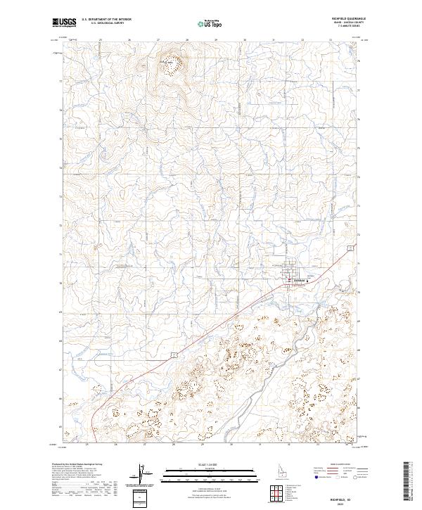
2023 Map of Richfield
USGS Topo · Published 2023About this map
The high-desert settlement of Richfield is the focal point of this modern Idaho landscape, where the town grid centers on S Main St and E Nez Perce St. This map reveals a complex irrigation architecture essential to local agriculture, defined by the West Main Canal, East Main Canal, and the Dietrich Main Canal. These primary arteries feed a dense network of smaller ditches, such as Lateral 357 and Lateral 1096, which crisscross the plains surrounding the town.
Find a feature on this map
67 named features on this map. Tap any name to fly to it.
Don’t see what you’re looking for? This feature index may not catch every label — zoom into the map to look around manually.
Map Details
Editions of this 2023 Richfield Map
This is the sole edition of this map. No revisions or reprints were ever made.
Other maps of this area

1955 · Twin Falls
USGS Topo · 1:250,000

1955 · Hailey
USGS Topo · 1:250,000

1958 · Twin Falls
USGS Topo · 1:250,000

1959 · Hailey
USGS Topo · 1:250,000

1962 · Hailey
USGS Topo · 1:250,000

1971 · Owinza
USGS Topo · 1:24,000

1971 · Dietrich
USGS Topo · 1:24,000

1971 · Dietrich Butte
USGS Topo · 1:24,000
1979 · Richfield
USGS Topo · 1:24,000

1979 · Shoshone Ice Cave
USGS Topo · 1:24,000