
1980 Map of Richfield
USGS Topo · Published 1987About this map
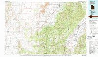
Volcanic geology meets the central Utah agricultural corridor in this study of the Sevier and Beaver River valleys. The landscape is dominated by the Pavant Range and the high elevations of the Fish Lake National Forest, which separate the fertile valley floor from the western desert. Notable geological features include the Lava and Cinders fields surrounding Tabernacle Hill, a stark contrast to the irrigated lands near Richfield and Fillmore.
Find a feature on this map
75 named features on this map. Tap any name to fly to it.
Don’t see what you’re looking for? This feature index may not catch every label — zoom into the map to look around manually.
Map Details
Editions of this 1980 Richfield Map
2 editions found
Other maps of this area

1885 · Manti
USGS Topo · 1:250,000

1885 · Beaver
USGS Topo · 1:250,000

1885 · Sevier Desert
USGS Topo · 1:250,000

1885 · Fish Lake
USGS Topo · 1:250,000

1895 · Manti
USGS Topo · 1:250,000

1896 · Fish Lake
USGS Topo · 1:250,000

1908 · Fish Springs
USGS Topo · 1:250,000

1910 · Fish Springs
USGS Topo · 1:250,000

1932 · Sevier
USGS Topo · 1:62,500

1935 · Sevier
USGS Topo · 1:62,500