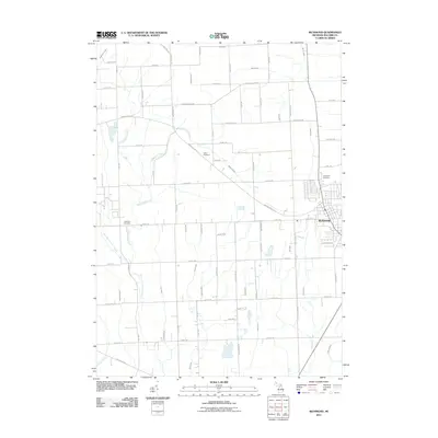
2011 Map of Richmond
USGS Topo · Published 2011About this map
Richmond serves as the primary urban center for this portion of Macomb County, situated amidst a highly structured grid of section roads and complex drainage networks. The landscape is defined by its transition from agricultural expanses to concentrated residential streets, particularly along Division Rd and Richwood Ln. For those tracing local heritage, several historic burial grounds are noted, including Richmond Cemetery on the eastern edge of town and Bates Cemetery further west along Armada Ridge Rd. The physical geography is dominated by numerous man-made and natural watercourses, such as the Salt River and Highbank Creek, which flow through the surrounding plains. The prominence of various drainage systems like Norton Drain and Logg Drain illustrates the sophisticated water management required for this fertile region of Michigan.
Find a feature on this map
67 named features on this map. Tap any name to fly to it.
Don’t see what you’re looking for? This feature index may not catch every label — zoom into the map to look around manually.
Map Details
Editions of this 2011 Richmond Map
This is the sole edition of this map. No revisions or reprints were ever made.
Other maps of this area

1912 · Mt Clemens
USGS Topo · 1:62,500

1914 · Armada
USGS Topo · 1:62,500

1914 · Algonac
USGS Topo · 1:62,500

1928 · Armada
USGS Topo · 1:62,500

1928 · Hicky
USGS Topo · 1:62,500

1929 · Mt Clemens
USGS Topo · 1:62,500

1936 · New Haven
USGS Topo · 1:31,680

1936 · Waldenburg
USGS Topo · 1:31,680

1936 · New Baltimore
USGS Topo · 1:31,680

1939 · New Baltimore
USGS Topo · 1:24,000