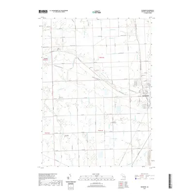
2019 Map of Richmond
USGS Topo · Published 2019About this map
The town of Richmond anchors the eastern edge of this Macomb County landscape, where the Macomb Orchard Rail Trail follows a historic corridor northwest toward Armada. This survey documents a transition from established town centers to a patchwork of agricultural lands defined by an extensive network of drainage systems, including Ryall Drain, Logg Drain, and Dixon Drain. For genealogists, the map is particularly detailed, identifying several rural burial sites such as Saint Joseph's Seminary Cem, the Lenox Centre Burial Grounds, and the Willow Grove Cem. The southern reach of the quadrangle is defined by the headwaters of the Salt River and its various tributaries like Shook Drain and Fistler Drain, alongside the small impoundment at Lake Chalet. The grid of section roads, from 34 Mile Rd down to 29 Mile Rd, reveals the enduring structure of the local land division.
Find a feature on this map
65 named features on this map. Tap any name to fly to it.
Don’t see what you’re looking for? This feature index may not catch every label — zoom into the map to look around manually.
Map Details
Editions of this 2019 Richmond Map
This is the sole edition of this map. No revisions or reprints were ever made.
Other maps of this area

1912 · Mt Clemens
USGS Topo · 1:62,500

1914 · Armada
USGS Topo · 1:62,500

1914 · Algonac
USGS Topo · 1:62,500

1928 · Armada
USGS Topo · 1:62,500

1928 · Hicky
USGS Topo · 1:62,500

1929 · Mt Clemens
USGS Topo · 1:62,500

1936 · New Haven
USGS Topo · 1:31,680

1936 · Waldenburg
USGS Topo · 1:31,680

1936 · New Baltimore
USGS Topo · 1:31,680

1939 · New Baltimore
USGS Topo · 1:24,000