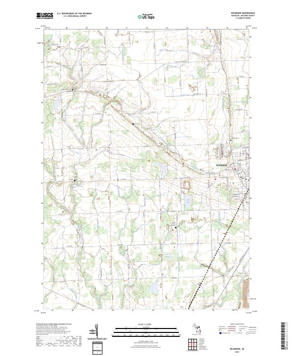
2023 Map of Richmond
USGS Topo · Published 2023About this map
Richmond sits at the heart of this Macomb County landscape, where the headwaters of numerous drains and creeks create a complex hydrologic network. The town's grid, featuring streets like Division Rd and Memphis Ridge Rd, reflects a history of regional connectivity. The surrounding countryside is defined by the Salt River and various watercourses such as Cemetery Creek and East Branch Coon Creek, which underscore the agricultural importance of the terrain. Local history and genealogy researchers will find several significant burial sites, including the Richmond Cem and the Lenox Centre Burial Grounds. Small bodies of water like Lake Chalet and Boss Lake punctuate the landscape, while the settlement of Richards and family-named landmarks like Willow Grove Cem and Bates Cem offer specific points of interest for those tracing family roots in this part of Michigan.
Find a feature on this map
97 named features on this map. Tap any name to fly to it.
Don’t see what you’re looking for? This feature index may not catch every label — zoom into the map to look around manually.
Map Details
Editions of this 2023 Richmond Map
This is the sole edition of this map. No revisions or reprints were ever made.
Other maps of this area

1912 · Mt Clemens
USGS Topo · 1:62,500

1914 · Armada
USGS Topo · 1:62,500

1914 · Algonac
USGS Topo · 1:62,500

1928 · Armada
USGS Topo · 1:62,500

1928 · Hicky
USGS Topo · 1:62,500

1929 · Mt Clemens
USGS Topo · 1:62,500

1936 · New Haven
USGS Topo · 1:31,680

1936 · Waldenburg
USGS Topo · 1:31,680

1936 · New Baltimore
USGS Topo · 1:31,680

1939 · New Baltimore
USGS Topo · 1:24,000