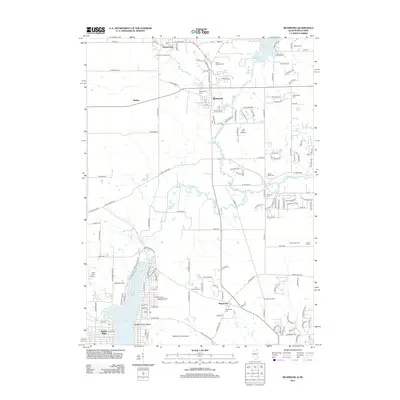
2012 Map of Richmond
USGS Topo · Published 2012About this map
Nippersink Creek and its north branch carve through the center of this northern Illinois landscape, defining the character of Richmond and the surrounding agricultural tracts. The map records a transition between early rural foundations and modern infrastructure, shown through a significant density of burial grounds such as Saint Josephs Cemetery, Solon Mills Cemetery, and Washington Cemetery. The local economy is represented by specialized operations like Keystone Hatcheries and the Pioneer Tree Farm, while the presence of Galt Field Airport and McHenry Farms Airport points to the area's role in regional aviation. Along the shores of Wonder Lake, residential developments like Wonder Center Beach and Sunrise Ridge illustrate the evolution of the shoreline from seasonal retreat to established community near the Wisconsin border.
Find a feature on this map
137 named features on this map. Tap any name to fly to it.
Don’t see what you’re looking for? This feature index may not catch every label — zoom into the map to look around manually.
Map Details
Editions of this 2012 Richmond Map
This is the sole edition of this map. No revisions or reprints were ever made.
Other maps of this area

1893 · Silver Lake
USGS Topo · 1:62,500

1893 · Geneva
USGS Topo · 1:62,500

1904 · Lake Geneva
USGS Topo · 1:62,500

1906 · Silver Lake
USGS Topo · 1:62,500

1906 · Lake Geneva
USGS Topo · 1:62,500

1920 · Grays Lake
USGS Topo · 1:62,500

1923 · Grays Lake
USGS Topo · 1:62,500

1926 · Mc Henry
USGS Topo · 1:62,500

1944 · McHenry
USGS Topo · 1:62,500

1954 · Rockford
USGS Topo · 1:250,000