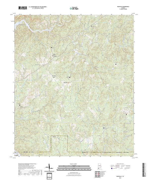
2024 Map of Richville
USGS Topo · Published 2024About this map
Richville and its surrounding hamlets occupy a landscape of complex drainage and rolling terrain in central Alabama. This modern survey illustrates a network of rural communities including Travelers Rest, Kellys Crossroads, Schley, and Welona. The topography is defined by the Weogufka Mountains in the northwest and numerous watercourses like Hatchet Creek, Swamp Creek, and Pinchoulee Creek that wind through the timbered hills. The area's settlement history is evident in its high density of family and community burial grounds, such as New Union Cem, Sardis Cem, and Murchison Cem.
Find a feature on this map
59 named features on this map. Tap any name to fly to it.
Don’t see what you’re looking for? This feature index may not catch every label — zoom into the map to look around manually.
Map Details
Editions of this 2024 Richville Map
This is the sole edition of this map. No revisions or reprints were ever made.
Other maps of this area

1901 · Wetumpka
USGS Topo · 1:125,000

1901 · Wetumpka
USGS Topo · 1:62,500

1903 · Wetumpka
USGS Topo · 1:125,000

1953 · Montgomery
USGS Topo · 1:250,000

1956 · Montgomery
USGS Topo · 1:250,000

1957 · Montgomery
USGS Topo · 1:250,000
1959 · Wetumpka
USGS Topo · 1:62,500

1959 · Elmore
USGS Topo · 1:62,500

1971 · Richville
USGS Topo · 1:24,000
1971 · Mitchell Dam NW
USGS Topo · 1:24,000