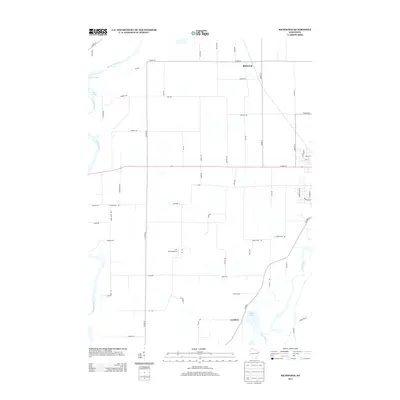
2013 Map of Richwood
USGS Topo · Published 2013About this map
The confluence of several major waterways defines the rural landscape of this Wisconsin region, where the Beaver Dam River and Crawfish River wind through the northwest while the Rock River curves through the southeast. The small settlement of Richwood sits near the northern boundary, characterized by a grid of local roads like Quarry Rd and Rich Rd that service the surrounding agricultural land. To the south, the community of Grellton is positioned near the shores of Hahns Lake, illustrating the typical pattern of wetland-adjacent settlement in this part of the state.
Find a feature on this map
61 named features on this map. Tap any name to fly to it.
Don’t see what you’re looking for? This feature index may not catch every label — zoom into the map to look around manually.
Map Details
Editions of this 2013 Richwood Map
This is the sole edition of this map. No revisions or reprints were ever made.
Other maps of this area

1891 · Waterloo
USGS Topo · 1:62,500

1892 · Watertown
USGS Topo · 1:62,500

1894 · Waterloo
USGS Topo · 1:62,500

1894 · Watertown
USGS Topo · 1:62,500

1910 · Waterloo
USGS Topo · 1:62,500

1955 · Beaver Dam
USGS Topo · 1:62,500

1955 · Horicon
USGS Topo · 1:62,500

1957 · Madison
USGS Topo · 1:250,000
1959 · Richwood
USGS Topo · 1:24,000
1959 · Waterloo
USGS Topo · 1:24,000