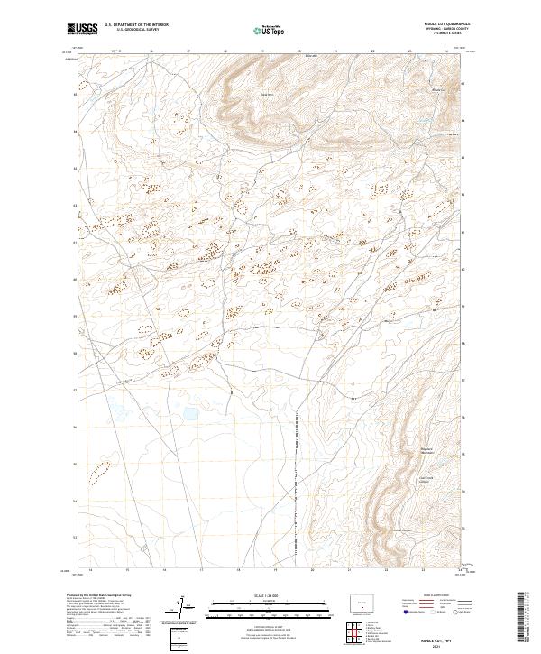
2021 Map of Riddle Cut
USGS Topo · Published 2021About this map
Table Mtn and the Haystack Mountains define the high-elevation terrain of this Carbon County landscape as it appeared in 2021. The map traces a network of drainages including Coal Cr and Corral Cr, which carve through deep formations like Coal Creek Canyon and Corral Canyon. This high-desert environment is sparsely developed, with the primary artery being Stone Ranch Rd, which winds through the central and northern sections of the quadrangle.
Find a feature on this map
15 named features on this map. Tap any name to fly to it.
Don’t see what you’re looking for? This feature index may not catch every label — zoom into the map to look around manually.
Map Details
Editions of this 2021 Riddle Cut Map
This is the sole edition of this map. No revisions or reprints were ever made.
Other maps of this area

1953 · Bradley Peak
USGS Topo · 1:24,000

1953 · Wild Horse Mountain
USGS Topo · 1:24,000

1953 · Ferris
USGS Topo · 1:24,000

1953 · Riddle Cut
USGS Topo · 1:24,000

1953 · Lone Haystack Mountain
USGS Topo · 1:24,000

1953 · Rawlins NW
USGS Topo · 1:24,000

1954 · Rawlins
USGS Topo · 1:250,000

1955 · Casper
USGS Topo · 1:250,000

1956 · Rawlins Peak
USGS Topo · 1:62,500

1958 · Rawlins
USGS Topo · 1:250,000