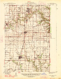
1947 Map of Ridge Farm
USGS Topo · Published 1947About this map
The Little Vermilion River carves through the landscape of eastern Illinois, where mid-century agriculture and coal industry infrastructure meet. Large settlements like Georgetown, Ridge Farm, and Chrisman are joined by the Chicago and Eastern Illinois RR, which runs north-to-south, while the Baltimore and Ohio RR intersects the southern portion of the sheet. The map reveals a dense network of early rural social life, evidenced by dozens of named country schools such as Oak Grove Sch and McKendree Sch, alongside numerous family-named burial grounds like the Martha Smith Cem and Sandusky Cem. Significant local landmarks like Mt Pisgah and Pleasant Mound rise above the terrain, while the eastern edge follows the Illinois Indiana border, showing the close connection between Humrick and the state line.
Find a feature on this map
77 named features on this map. Tap any name to fly to it.
Don’t see what you’re looking for? This feature index may not catch every label — zoom into the map to look around manually.
Map Details
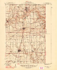
Editions of this 1947 Ridge Farm Map
3 editions found
Other maps of this area

1899 · Danville
USGS Topo · 1:62,500

1900 · Danville
USGS Topo · 1:62,500

1931 · Fithian
USGS Topo · 1:48,000

1943 · Fithian
USGS Topo · 1:62,500

1946 · Kansas
USGS Topo · 1:62,500

1947 · Ridge Farm
USGS Topo · 1:62,500

1947 · Paris
USGS Topo · 1:62,500

1949 · Kansas
USGS Topo · 1:62,500

1949 · Paris
USGS Topo · 1:62,500

1949 · Danville SW
USGS Topo · 1:24,000