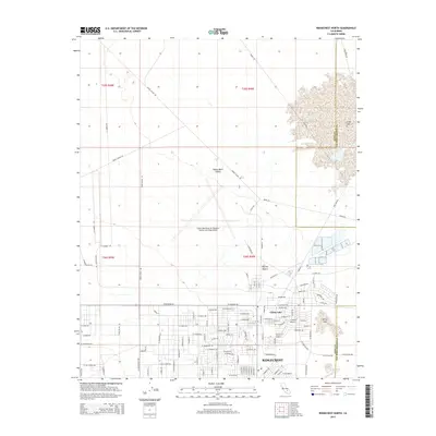
2015 Map of Ridgecrest North
USGS Topo · Published 2015About this map
China Lake Naval Air Weapons Station (Armitage Field) dominates this portion of the Indian Wells Valley, illustrating the intersection of military infrastructure and the high desert environment. The expansive facility sits adjacent to the residential and commercial streets of Ridgecrest and the housing areas of China Lake, where roads like Iwo Jima Rd and Nimitz Ave reflect the area's naval heritage. To the east, the landscape transitions into the Mojave Desert, marked by the seasonal waters of Mirror Lake and the dry bed of China Lake. This map captures a significant concentration of specialized transit routes, including the Snort Bypass Rd and various range access corridors that stretch north toward the Kern and San Bernardino county line. The grid system of Ridgecrest shows the developed footprint of the community as it stood in the mid-2010s, contrasting sharply with the open alkaline flats and desert basins to the north.
Find a feature on this map
108 named features on this map. Tap any name to fly to it.
Don’t see what you’re looking for? This feature index may not catch every label — zoom into the map to look around manually.
Map Details
Editions of this 2015 Ridgecrest North Map
This is the sole edition of this map. No revisions or reprints were ever made.
Other maps of this area

1915 · Searles Lake
USGS Topo · 1:250,000

1943 · Inyokern
USGS Topo · 1:62,500

1947 · Trona
USGS Topo · 1:250,000

1948 · Trona
USGS Topo · 1:250,000

1953 · Mountain Springs Canyon
USGS Topo · 1:62,500

1953 · Ridgecrest
USGS Topo · 1:62,500

1953 · Trona
USGS Topo · 1:250,000

1954 · Little Lake
USGS Topo · 1:62,500

1957 · Trona
USGS Topo · 1:250,000

1960 · Trona
USGS Topo · 1:250,000