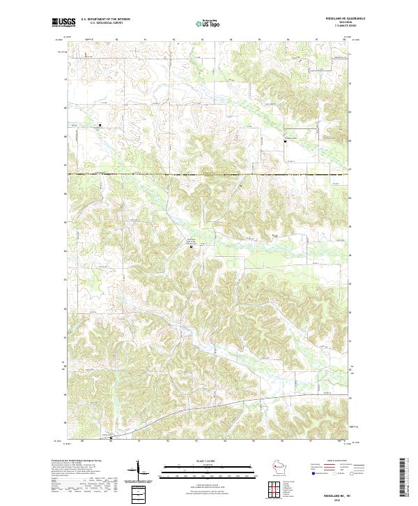
2022 Map of Ridgeland NE
USGS Topo · Published 2022About this map
Barron and Dunn counties meet along a landscape defined by the intricate branching of the Red Cedar River watershed. This modern survey illustrates the persistent rural character of the region, where land use follows the winding paths of Upper Pine Cr, Lower Pine Cr, and Hay Cr. Local heritage is anchored by several long-standing burial sites, including New Hope Pine Creek Lutheran Cem and Greenwood Cem, which serve as markers for the early families who settled these uplands. The road network, composed of a mix of county highways like Co Hwy A and localized routes such as Brewer Hill Rd, reveals a settlement pattern that has remained largely agricultural and dispersed into the twenty-first century. The topography is further etched by smaller tributaries like Blairmoor Br, which dictate the placement of farms and homesteads.
Find a feature on this map
39 named features on this map. Tap any name to fly to it.
Don’t see what you’re looking for? This feature index may not catch every label — zoom into the map to look around manually.
Map Details
Editions of this 2022 Ridgeland NE Map
This is the sole edition of this map. No revisions or reprints were ever made.
Other maps of this area

1949 · New Auburn
USGS Topo · 1:62,500

1949 · Ridgeland
USGS Topo · 1:62,500

1951 · Ridgeland
USGS Topo · 1:62,500

1951 · New Auburn
USGS Topo · 1:62,500

1951 · Chetek
USGS Topo · 1:62,500

1951 · Barron
USGS Topo · 1:62,500

1953 · Rice Lake
USGS Topo · 1:250,000

1959 · Rice Lake
USGS Topo · 1:250,000
1975 · Colfax North
USGS Topo · 1:24,000
1975 · Sand Creek
USGS Topo · 1:24,000