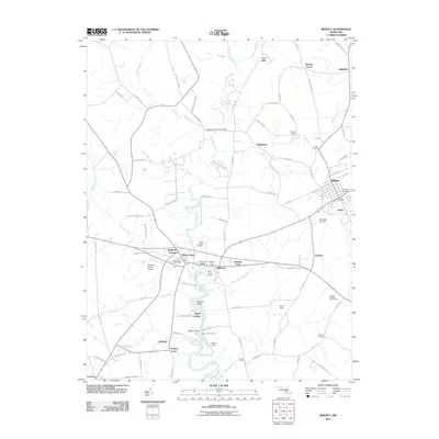
2011 Map of Ridgely
USGS Topo · Published 2011About this map
Tuckahoe Creek carves a winding path through this portion of Caroline County, defining the landscape between the established town of Ridgely and the twin communities of Hillsboro and Queen Anne. In the early 21st century, this area remains a patchwork of agricultural fields and small settlements, connected by a network of rural roads such as Crouse Mill Rd and Sawmill Rd. The map documents numerous family-named corners and landings, including Buckels Corner, Mitchell Corner, and Stony Point Landing, which reflect the region's deep-rooted land ownership and river-oriented history.
Find a feature on this map
89 named features on this map. Tap any name to fly to it.
Don’t see what you’re looking for? This feature index may not catch every label — zoom into the map to look around manually.
Map Details
Editions of this 2011 Ridgely Map
This is the sole edition of this map. No revisions or reprints were ever made.
Other maps of this area

1898 · Choptank
USGS Topo · 1:125,000

1898 · Tolchester
USGS Topo · 1:125,000

1899 · Dover
USGS Topo · 1:125,000

1901 · Chestertown
USGS Topo · 1:62,500

1903 · Tolchester
USGS Topo · 1:125,000

1904 · St. Michaels
USGS Topo · 1:62,500

1905 · Denton
USGS Topo · 1:62,500

1905 · Barclay
USGS Topo · 1:62,500

1906 · Dover
USGS Topo · 1:125,000

1908 · Tolchester
USGS Topo · 1:125,000