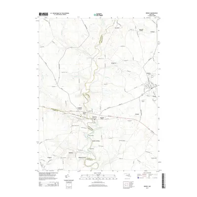
2014 Map of Ridgely
USGS Topo · Published 2014About this map
Tuckahoe Creek serves as a natural boundary dividing the landscape into several Eastern Shore jurisdictions, including Queen Anne's Co, Caroline Co, and Talbot Co. The settlement of Ridgely is the primary hub, featuring a detailed street grid and the Ridgely Cem. Along the banks of the creek, historic crossings and landings like the Tuckahoe Bridge and Rolph Landing indicate the long-standing importance of water transit and local commerce. Smaller clusters like Queen Anne and Hillsboro sit near the river's edge, home to Saint Pauls Cem and Green Mt Cem. Further out, the landscape is defined by agricultural lands and private aviation strips such as Carmean Airport and Meadow Brook Airport, reflecting the rural character of the region in the early twenty-first century.
Find a feature on this map
110 named features on this map. Tap any name to fly to it.
Don’t see what you’re looking for? This feature index may not catch every label — zoom into the map to look around manually.
Map Details
Editions of this 2014 Ridgely Map
This is the sole edition of this map. No revisions or reprints were ever made.
Other maps of this area

1898 · Choptank
USGS Topo · 1:125,000

1898 · Tolchester
USGS Topo · 1:125,000

1899 · Dover
USGS Topo · 1:125,000

1901 · Chestertown
USGS Topo · 1:62,500

1903 · Tolchester
USGS Topo · 1:125,000

1904 · St. Michaels
USGS Topo · 1:62,500

1905 · Denton
USGS Topo · 1:62,500

1905 · Barclay
USGS Topo · 1:62,500

1906 · Dover
USGS Topo · 1:125,000

1908 · Tolchester
USGS Topo · 1:125,000