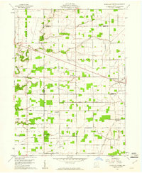
1959 Map of Ridgeville Corners
USGS Topo · Published 1961About this map
Ridgeville Corners serves as the primary hub in this late 1950s survey of Northwest Ohio, where the intersection of major roads defines the local economy and social structure. The landscape is marked by a grid of rural infrastructure, featuring family-named thoroughfares such as Mekus Road, Arps Road, and Coressell Road that connect isolated farmsteads. This map captures the administrative complexity of the region, where the boundaries of Williams, Fulton, and Defiance counties meet, influencing the placement of local landmarks and institutions.
Find a feature on this map
27 named features on this map. Tap any name to fly to it.
Don’t see what you’re looking for? This feature index may not catch every label — zoom into the map to look around manually.
Map Details
Editions of this 1959 Ridgeville Corners Map
3 editions found
Other maps of this area

1907 · Defiance
USGS Topo · 1:62,500

1908 · Napoleon
USGS Topo · 1:62,500

1909 · Defiance
USGS Topo · 1:62,500

1911 · Wauseon
USGS Topo · 1:62,500

1913 · Wauseon
USGS Topo · 1:62,500

1913 · Alvordton
USGS Topo · 1:62,500

1943 · Wauseon
USGS Topo · 1:62,500

1944 · Alvordton
USGS Topo · 1:62,500

1953 · Fort Wayne
USGS Topo · 1:250,000

1956 · Fort Wayne
USGS Topo · 1:250,000