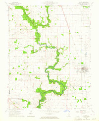
1963 Map of Ridgway
USGS Topo · Published 1964About this map
North Fork Saline River meanders through the central landscape of this Gallatin County quadrangle, carving a distinctive greenbelt of timber and wetlands through the agricultural plains. The town of Ridgway serves as the local hub, situated east of the river and south of Crawford Creek. This 1963 field-checked survey reveals an economy and community structure shaped by both natural resources and traditional transit, visible in the sprawling Omaha Oil and Gas Field to the north and the steady line of the Baltimore and Ohio railroad. Local history is deeply etched into the rural landscape through a network of country churches and burial grounds, such as Poplar Ch, Oak Grove Ch, and the St Josephs Cem. The map captures the region just before significant changes in rural land use, documenting small settlements like Elba and geographic landmarks such as Gold Hill to the south.
Find a feature on this map
28 named features on this map. Tap any name to fly to it.
Don’t see what you’re looking for? This feature index may not catch every label — zoom into the map to look around manually.
Map Details
Editions of this 1963 Ridgway Map
2 editions found
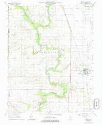
Other maps of this area

1905 · Eldorado
USGS Topo · 1:62,500

1905 · New Haven
USGS Topo · 1:62,500

1906 · New Haven
USGS Topo · 1:62,500

1906 · Eldorado
USGS Topo · 1:62,500

1916 · Shawneetown
USGS Topo · 1:62,500

1916 · Equality
USGS Topo · 1:62,500

1949 · Paducah
USGS Topo · 1:250,000

1949 · New Haven
USGS Topo · 1:62,500

1950 · Paducah
USGS Topo · 1:250,000

1954 · Paducah
USGS Topo · 1:250,000