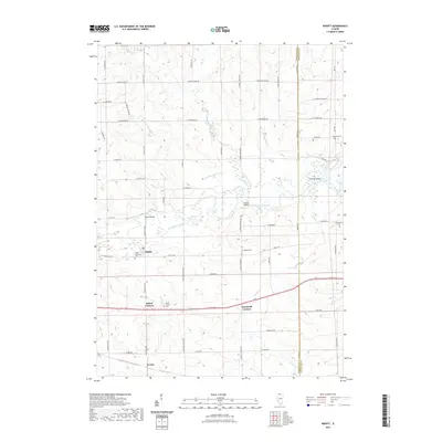
2021 Map of Ridott
USGS Topo · Published 2021About this map
The Pecatonica River winds through the heart of this Stephenson County landscape, defining the character of the small village of Ridott. This region is shaped by the transition of waterways like Rock Run and Sumner Creek as they feed the larger river system. Local transit and land division are etched into the grid of rural roads such as N Rock City Rd and E Ridott Rd, which connect scattered residential clusters and farming tracts. Genealogy interest is anchored by several burial grounds, including the Ridott Township Cem and Wagner Cem. The river's influence is seen in features like Sumner Island and key crossings at Ridott Bridge and Farwell Bridge. Smaller rural communities like Ridott Corners, Woodruff Corners, and Evarts appear as distinct nodes within the agricultural and floodplain environment.
Find a feature on this map
62 named features on this map. Tap any name to fly to it.
Don’t see what you’re looking for? This feature index may not catch every label — zoom into the map to look around manually.
Map Details
Editions of this 2021 Ridott Map
This is the sole edition of this map. No revisions or reprints were ever made.
Other maps of this area

1922 · Oregon
USGS Topo · 1:62,500

1924 · Oregon
USGS Topo · 1:62,500

1932 · Pecatonica
USGS Topo · 1:62,500

1936 · Pecatonica
USGS Topo · 1:62,500

1939 · Freeport
USGS Topo · 1:48,000

1942 · Forreston
USGS Topo · 1:62,500

1944 · Freeport
USGS Topo · 1:62,500

1945 · Forreston
USGS Topo · 1:62,500

1954 · Rockford
USGS Topo · 1:250,000

1955 · Rockford
USGS Topo · 1:250,000