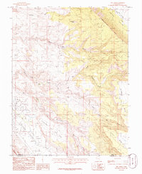
1985 Map of Rill Creek
USGS Topo · Published 1986About this map
Castle Valley and the formidable Porcupine Rim dominate this high-desert landscape in southeastern Utah during the mid-1980s. The map illustrates a complex network of canyons and drainage systems, including Negro Bill Canyon, Jackass Canyon, and Drinks Canyon, which carve through the arid plateaus. On the higher elevations, named features like Johnsons Up On Top and Wilson Mesa provide distinct landmarks for navigation and land use.
Find a feature on this map
27 named features on this map. Tap any name to fly to it.
Don’t see what you’re looking for? This feature index may not catch every label — zoom into the map to look around manually.
Map Details
Editions of this 1985 Rill Creek Map
2 editions found
Other maps of this area

1885 · La Sal
USGS Topo · 1:250,000

1954 · Mt Peale 2 NW
USGS Topo · 1:24,000

1954 · Mt. Waas 3 NE
USGS Topo · 1:24,000

1954 · Mt. Waas 3 SE
USGS Topo · 1:24,000

1954 · Carlisle 1 NE
USGS Topo · 1:24,000

1954 · Mt Peale 2 NE
USGS Topo · 1:24,000

1954 · Mt. Waas 3 NW
USGS Topo · 1:24,000

1954 · Mt. Waas 3 SW
USGS Topo · 1:24,000

1954 · La Sal Junction
USGS Topo · 1:62,500

1954 · Castle Valley
USGS Topo · 1:62,500