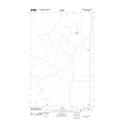
2011 Map of Rimrock Ranch
USGS Topo · Published 2011About this map
Big Sky Colony and the nearby Rimrock Ranch define this pocket of Glacier County, characterized by a sparse network of prairie roads and deep drainage features. The landscape is marked by several significant coulees, including Little Rock Coulee to the east and both Cobell Coulee and Powell Coulee along the southern boundary. These seasonal watercourses carve through the terrain, dictating the placement of rural infrastructure like Horsethief Rd. This 2011 survey captures the area's agricultural organization, showing the relationship between established ranching outposts and the vast, open drainage basins typical of northern Montana's high plains.
Find a feature on this map
6 named features on this map. Tap any name to fly to it.
Don’t see what you’re looking for? This feature index may not catch every label — zoom into the map to look around manually.
Map Details
Editions of this 2011 Rimrock Ranch Map
This is the sole edition of this map. No revisions or reprints were ever made.
Other maps of this area

1911 · Blackfoot
USGS Topo · 1:125,000

1960 · Cut Bank
USGS Topo · 1:250,000

1963 · Cut Bank
USGS Topo · 1:250,000

1964 · Cut Bank
USGS Topo · 1:250,000

1968 · Buffalo Lake
USGS Topo · 1:24,000

1968 · Rimrock Butte
USGS Topo · 1:24,000
1968 · Fort Piegan
USGS Topo · 1:24,000
1968 · Del Bonita
USGS Topo · 1:24,000
1968 · Sharp Lake
USGS Topo · 1:24,000

1968 · Landslide Butte
USGS Topo · 1:24,000